
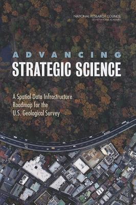
Advancing Strategic Science : A Spatial Data Infrastructure Roadmap for the U.S. Geological Survey
Book Details
Format
Paperback / softback
ISBN-10
030926457X
ISBN-13
9780309264570
Publisher
National Academies Press
Imprint
National Academies Press
Country of Manufacture
US
Country of Publication
GB
Publication Date
Oct 26th, 2012
Print length
132 Pages
Product Classification:
Earth sciencesGeology & the lithosphereGeography
KSh 5,400.00
Publisher Out of Stock
0 in stock
Delivery Location
Delivery fee: Select location
Secure
Quality
Fast
Science is increasingly driven by data, and spatial data underpin the science directions laid out in the 2007 U.S. Geological Survey (USGS) Science Strategy. A robust framework of spatial data, metadata, tools, and a user community that is interactively connected to use spatial data in an efficient and flexible way—known as a spatial data infrastructure (SDI)—must be available for scientists and managers to find, use, and share spatial data both within and beyond the USGS. Over the last decade, the USGS has conducted breakthrough research that has overcome some of the challenges associated with implementing a large SDI. Advancing Strategic Science: A Spatial Data Infrastructure Roadmap for the U.S. Geological Survey is intended to ground those efforts by providing a practical roadmap to full implementation of an SDI to enable the USGS to conduct strategic science. Table of ContentsFront MatterSummary1 Introduction2 Background3 Key Challenges and Lessons Learned4 A Vision for Optimizing the USGS Spatial Data Infrastructure5 A Roadmap for Spatial Data Infrastructure ImplementationAppendixesAppendix A: Committee and Staff BiographiesAppendix B: Presentations to the CommitteeAppendix C: On-Line QuestionnaireAppendix D: Questionnaire Responses
Get Advancing Strategic Science by Board on Earth Sciences and Resources, Committee on Spatial Data Enabling USGS Strategic Science in the 21st Century at the best price and quality guaranteed only at Werezi Africa's largest book ecommerce store. The book was published by National Academies Press and it has 132 pages.
Customers Who Bought This Also Bought

Genius of Trees
KSh 4,500.00

Genius of Trees
KSh 3,050.00

Genius of Trees
KSh 2,350.00

Recent Geotechnical Research at BOKU
KSh 27,000.00

An Introduction to the Study of Meteorites, Etc.
KSh 2,700.00

Intraterrestrials
KSh 2,900.00

Australia's Amazing Dinosaurs
KSh 2,050.00

Beyond Algorithms
KSh 22,500.00

Marsh Mud and Mummichogs
KSh 7,650.00

Marsh Mud and Mummichogs
KSh 4,600.00

Carbonate Depositional Systems
KSh 16,200.00

Crustal Heat Flow
KSh 12,950.00
More by Board on Earth Sciences and Resources, Committee on Spatial Data Enabling USGS Strategic Science in the 21st Century
Living on an Active Earth
KSh 14,600.00

Calculating the Secrets of Life
KSh 24,650.00

Eager to Learn
KSh 9,550.00

Enhancing Professional Development for Teachers
KSh 7,400.00

Aviation Safety and Pilot Control
KSh 19,600.00

Vision and Voyages for Planetary Science in the Decade 2013-2022
KSh 7,550.00

Discipline-Based Education Research
KSh 6,650.00

Zero-Sustainment Aircraft for the U.S. Air Force
KSh 4,300.00

The Unique U.S.-Russian Relationship in Biological Science and Biotechnology
KSh 7,400.00

Technology Pathways
KSh 7,400.00

Implementing the New Biology
KSh 7,400.00

Sharing Research Data
KSh 29,350.00