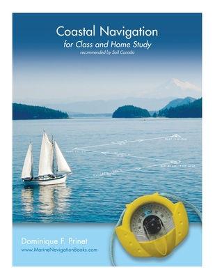
Coastal Navigation : for Class and Home Study
Book Details
Format
Paperback / softback
ISBN-10
1525503111
ISBN-13
9781525503115
Publisher
FriesenPress
Imprint
FriesenPress
Country of Manufacture
GB
Country of Publication
GB
Publication Date
Jan 9th, 2017
Print length
144 Pages
Weight
466 grams
Dimensions
21.50 x 28.10 x 1.30 cms
KSh 4,000.00
Manufactured on Demand
Delivery in 49 days
7 copies in stock
Delivery Location
Delivery fee: Select location
Delivery in 49 days
Secure
Quality
Fast
Coastal Navigation for Class and Home Study is based on the notes prepared for students by the author during some 20 years of teaching navigation, initially to private or commercial pilots, and then to sailors and professional mariners.
The book is copiously illustrated with graphics which explain chart projections, scales and symbols, and describe lights and other navigation aids. It demystifies the True, Magnetic and Compass Norths as well as problems of time, speed and distances, and explains how to plot courses and take bearings, or draw regular and advanced Lines of Position using the international system of labeling.
The book further clarifies the use of vectors to easily determine the impact of a current on the boat speed and direction, and goes on to show how to evaluate tides and currents. The final sections describe the use of GPS and electronic charts, highlighting their limitations. Additional notes and explanations are given in the areas where students traditionally experience difficulties, as well as supplementary examples and exercises.
The companion book, Coastal Navigation Exercises, offers all the exercises needed for practice.
The book is copiously illustrated with graphics which explain chart projections, scales and symbols, and describe lights and other navigation aids. It demystifies the True, Magnetic and Compass Norths as well as problems of time, speed and distances, and explains how to plot courses and take bearings, or draw regular and advanced Lines of Position using the international system of labeling.
The book further clarifies the use of vectors to easily determine the impact of a current on the boat speed and direction, and goes on to show how to evaluate tides and currents. The final sections describe the use of GPS and electronic charts, highlighting their limitations. Additional notes and explanations are given in the areas where students traditionally experience difficulties, as well as supplementary examples and exercises.
The companion book, Coastal Navigation Exercises, offers all the exercises needed for practice.
Get Coastal Navigation by Dominique F Prinet at the best price and quality guaranteed only at Werezi Africa's largest book ecommerce store. The book was published by FriesenPress and it has 144 pages.
Customers Who Bought This Also Bought

Maurice and Maralyn
KSh 2,000.00

Ocean Plotting Sheets - Northern Hemisphere
KSh 2,500.00

The Sextant Handbook
KSh 3,250.00

E3 Arquipelago da Madeira
KSh 4,300.00

Big Data Analytics for Connected Vehicles and Smart Cities
KSh 16,900.00
SAS Tracking & Navigation Handbook
KSh 2,750.00

2200 The Solent Chart Pack
KSh 10,900.00

Cornell''s World Voyage Planner 4th edition
KSh 9,650.00

Lifeboat at End of World
KSh 2,000.00
Seamanship
KSh 2,700.00

M31 Sicily
KSh 4,300.00

C38 Anse de Benodet to Presqu''ile de Quiberon
KSh 5,200.00